BREATHTAKING TRAILS
BEAUTIFUL BRITISH COLUMBIA
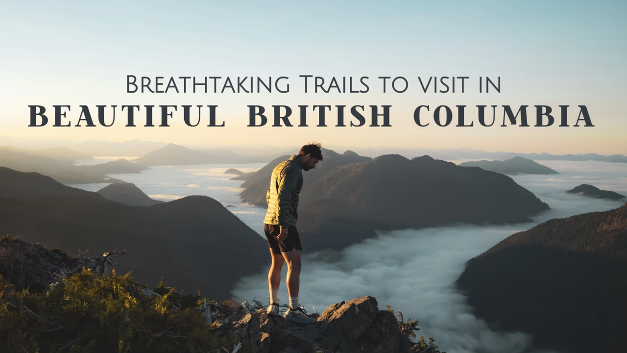
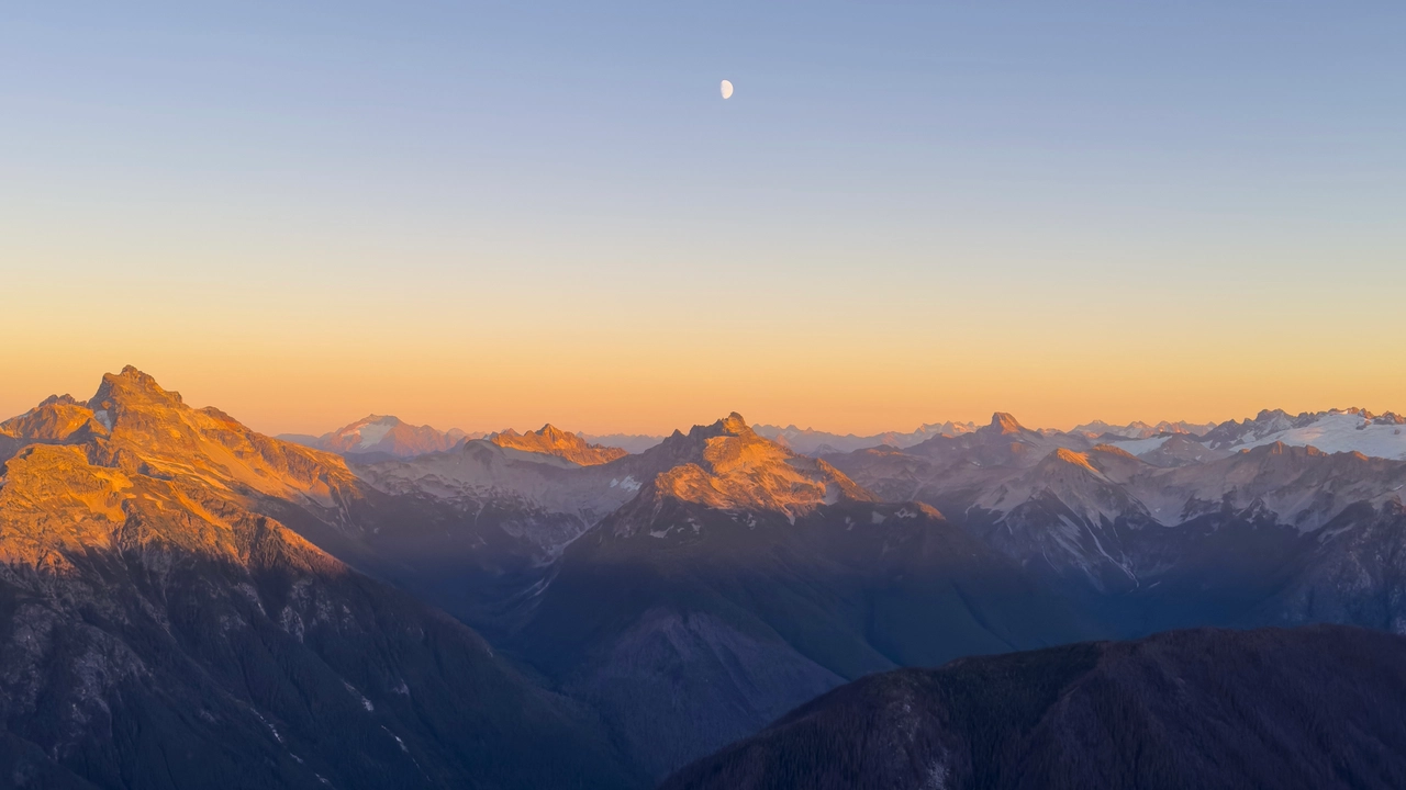
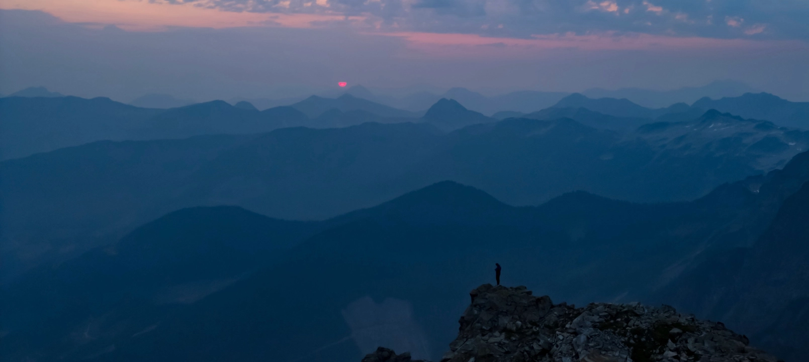
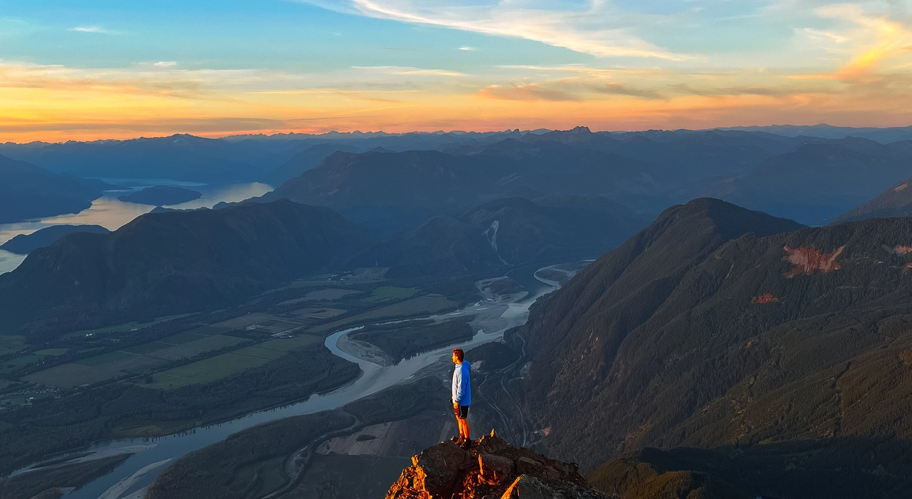
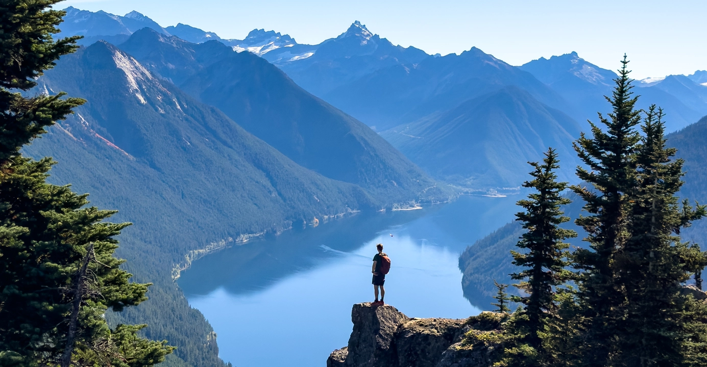
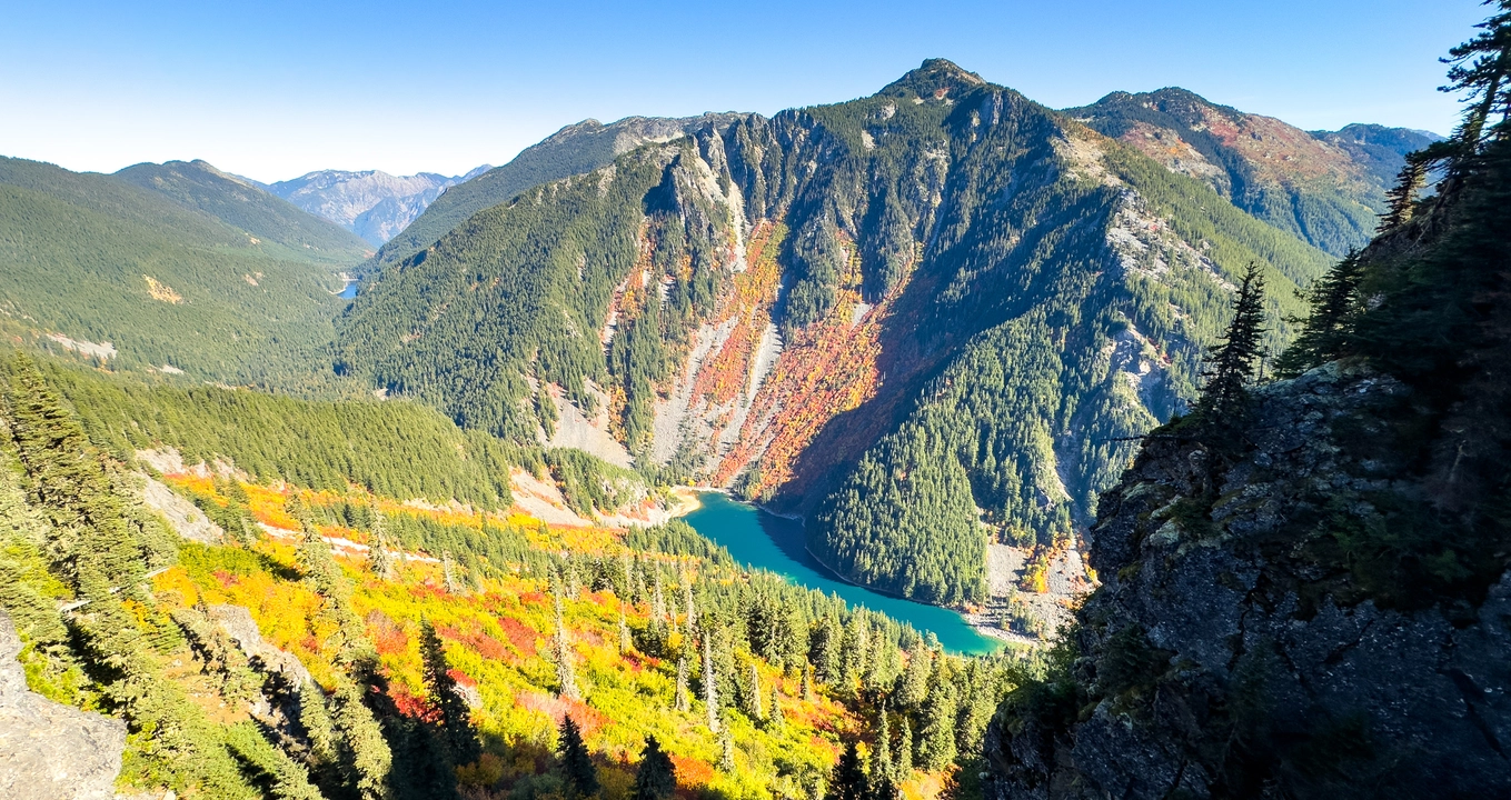
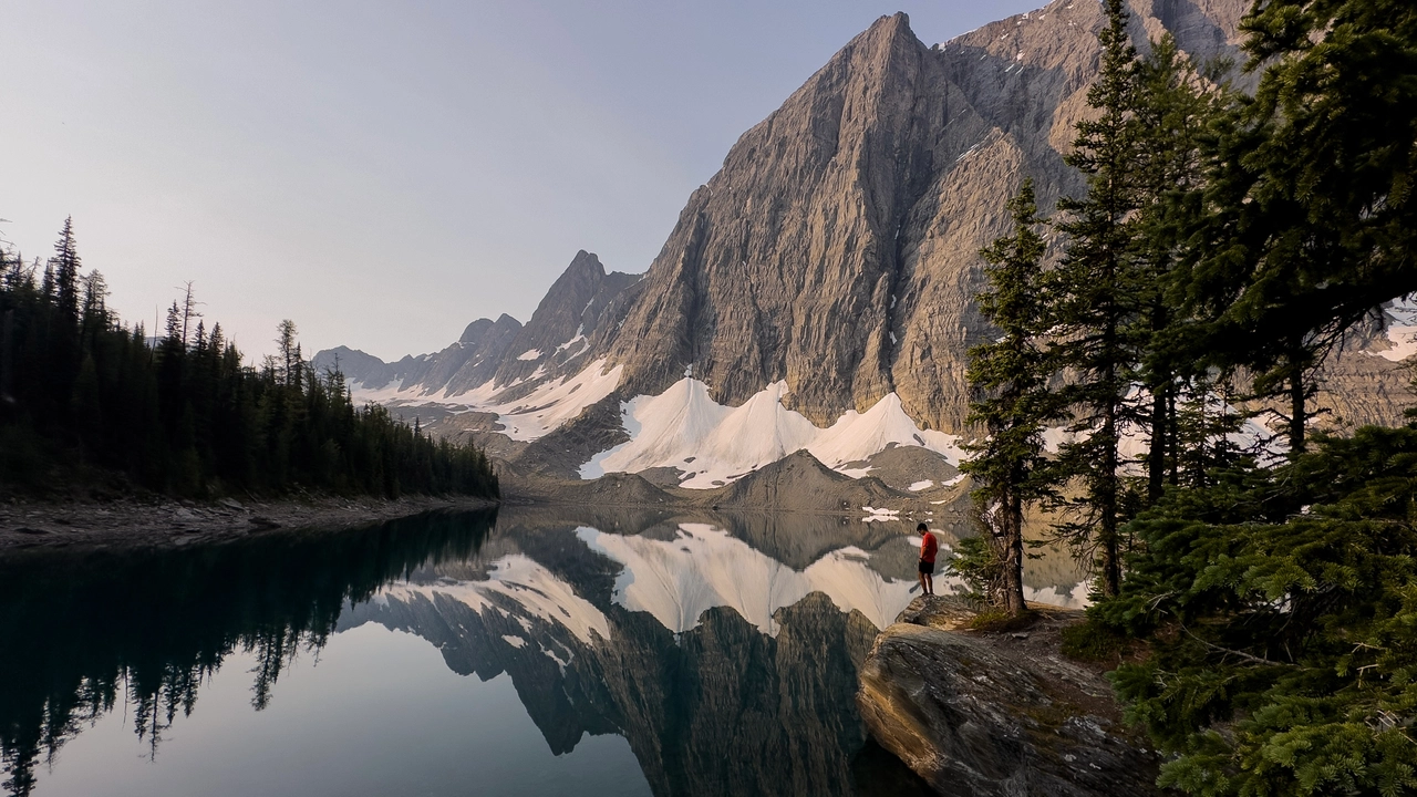
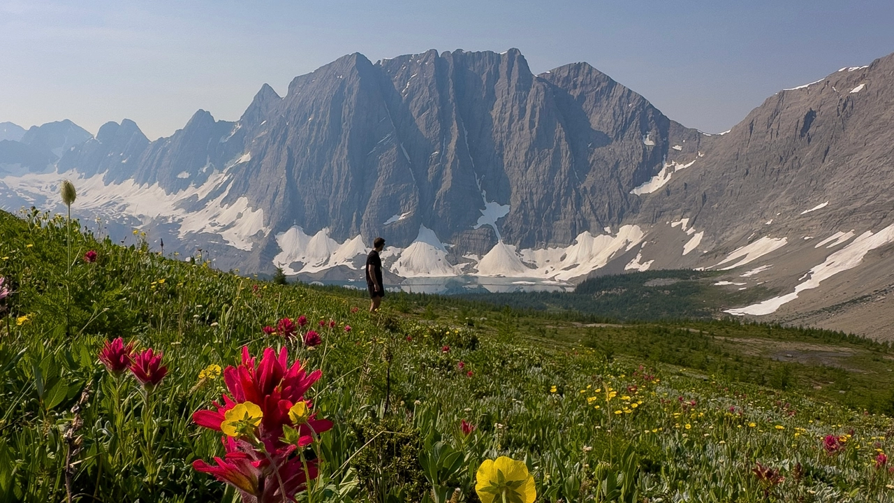
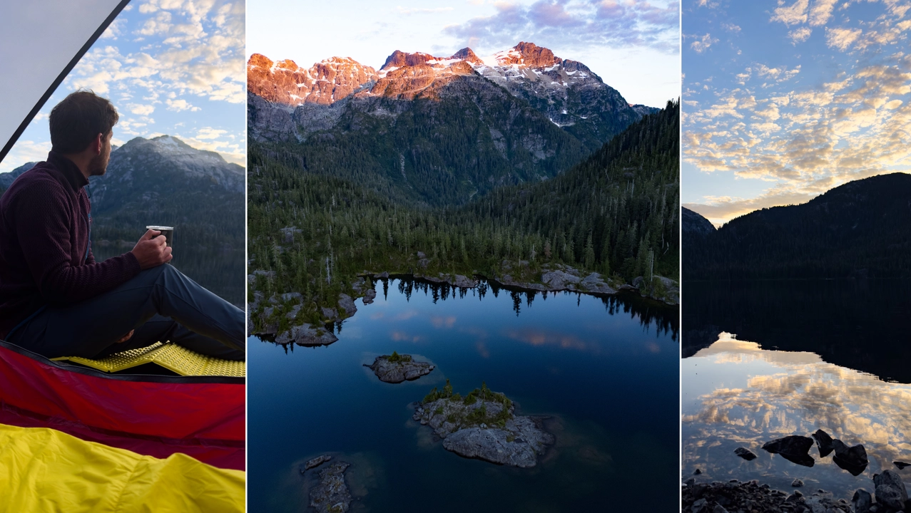
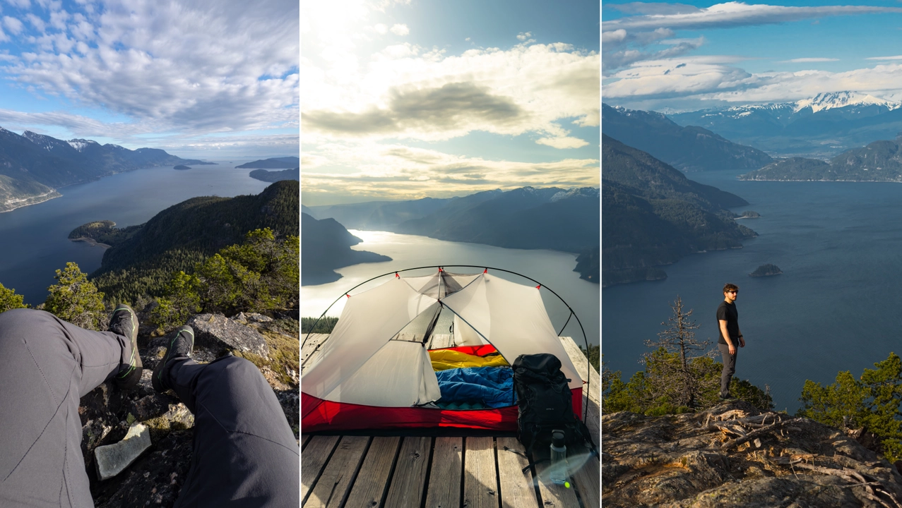
Over the past three years, spending time in the mountains of British Columbia has truly changed my life. Every hike, every summit, and every quiet moment surrounded by nature has brought me a deeper sense of peace and connection than I ever imagined. This place is more than just beautiful; it is where I have felt the most alive, grounded, and free. The landscapes, from sparkling alpine lakes and wildflower-filled meadows to towering peaks and misty forests, are pure magic. The mountains have taught me to slow down, to breathe, and to appreciate the simple moments that make life meaningful. Whether I was watching the sunrise from a ridgeline or sharing laughter with friends beside a mountain lake, each experience has filled my heart and soul. British Columbia has a way of reminding me how beautiful the world can be and how much joy can be found just by being present in nature.
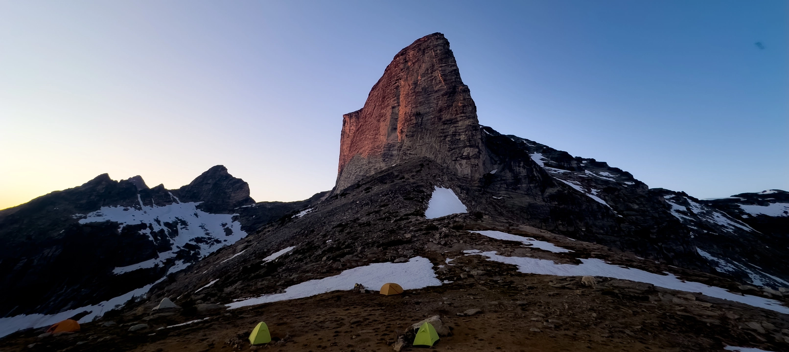
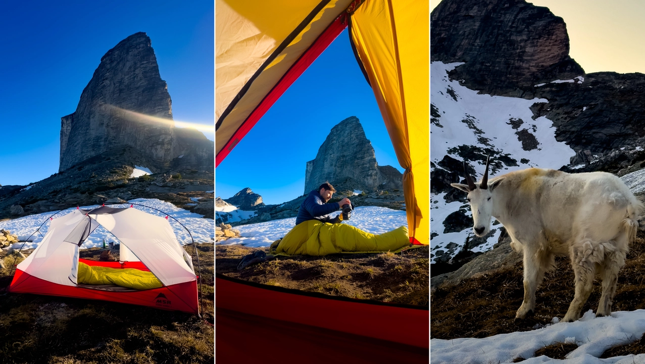
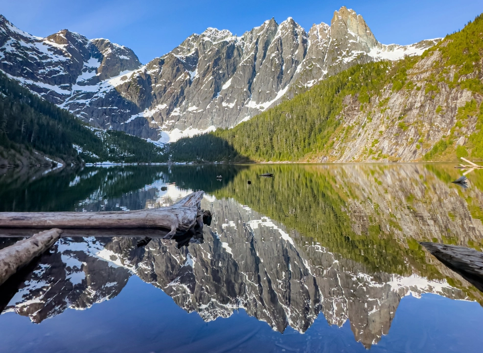
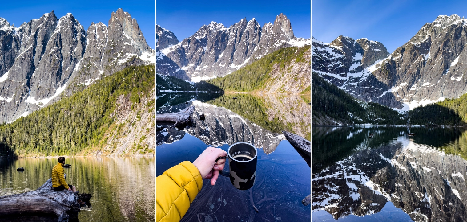
1. BUGABOO COBALT LAKE
Bugaboo Provincial Park
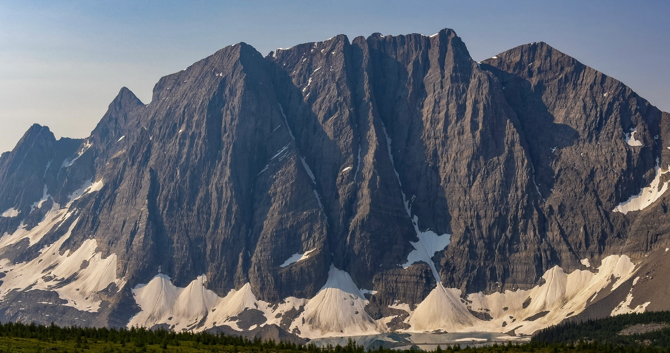
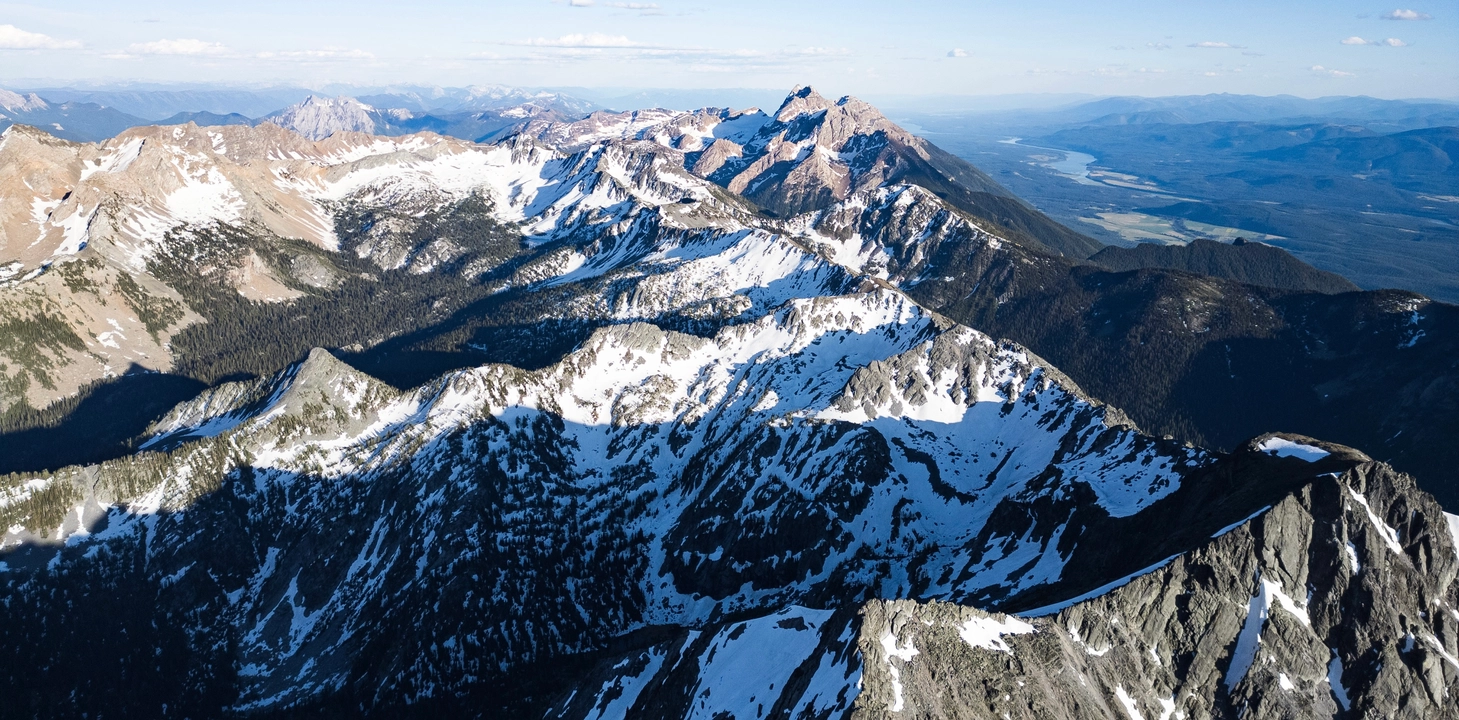
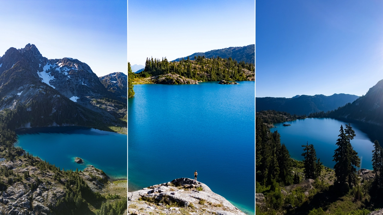
Hiking to Cobalt Lake in Bugaboo Provincial Park is a demanding yet rewarding alpine adventure in British Columbia’s Purcell Mountains. The trail spans approximately 8.5 km one-way, beginning near the Conrad Kain Hut parking area and ascending through steep switchbacks, larch forests, and alpine meadows. The initial 6.5 km climb gains about 875 meters to Black Forest Ridge, followed by a 2 km route that descends and then ascends again, requiring route-finding skills as it is unmarked and indistinct through alpine terrain . The final approach to the lake involves navigating rugged terrain without a defined path, so hikers should be comfortable with off-trail navigation.
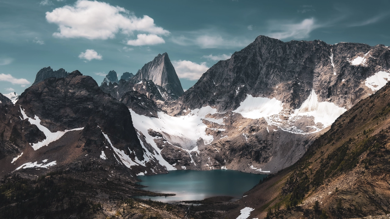
The trail offers panoramic views of the Bugaboo Spires and the vivid turquoise waters of Cobalt Lake, set against dramatic peaks and glaciers. The lake is often frozen late into summer, with snow patches on the shore . Hikers should be prepared for rapid weather changes, bring proper footwear for uneven ground, and consider trekking poles for the steeper sections. Late summer is the best time to visit, when snow has melted and wildflowers are in bloom.
Please note that the access road to the trailhead is a rough Forest Service Road (~45 km) with soft muddy sections and large potholes. Travel with caution and watch for resource industry traffic; use of a radio is recommended during vehicle travel .
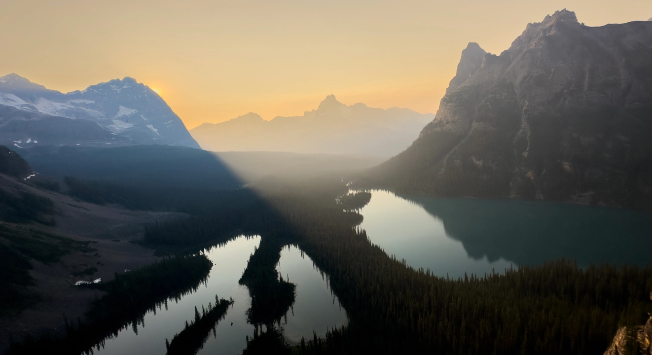
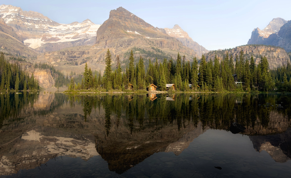
2. LAKE O'HARA
YOHO National Park
Hiking to the Opabin Prospect in Yoho National Park offers one of the most iconic sunset viewpoints in the Canadian Rockies. The trail begins at the southwest corner of Lake O’Hara, ascending via the West Opabin Trail through larch forests and alpine meadows to reach the Opabin Plateau. This moderate hike covers approximately 5.9 km round-trip with an elevation gain of about 250 meters. From the plateau, a short side trail leads to the Opabin Prospect, a rocky outcrop that provides breathtaking panoramic views of Lake O’Hara, Mary Lake, and the surrounding peaks, especially stunning during the golden hours of sunset.
The trail is well-marked and maintained, but hikers should be prepared for rapidly changing mountain weather and carry appropriate gear, including layers and headlamps if descending after sunset. Access to Lake O’Hara is restricted to protect its sensitive environment; visitors must secure a reservation for the shuttle bus or be prepared for an 11 km hike along the access road to reach the trailhead. Late summer and early fall are ideal times to visit, with longer daylight hours and the added beauty of golden larches enhancing the landscape.
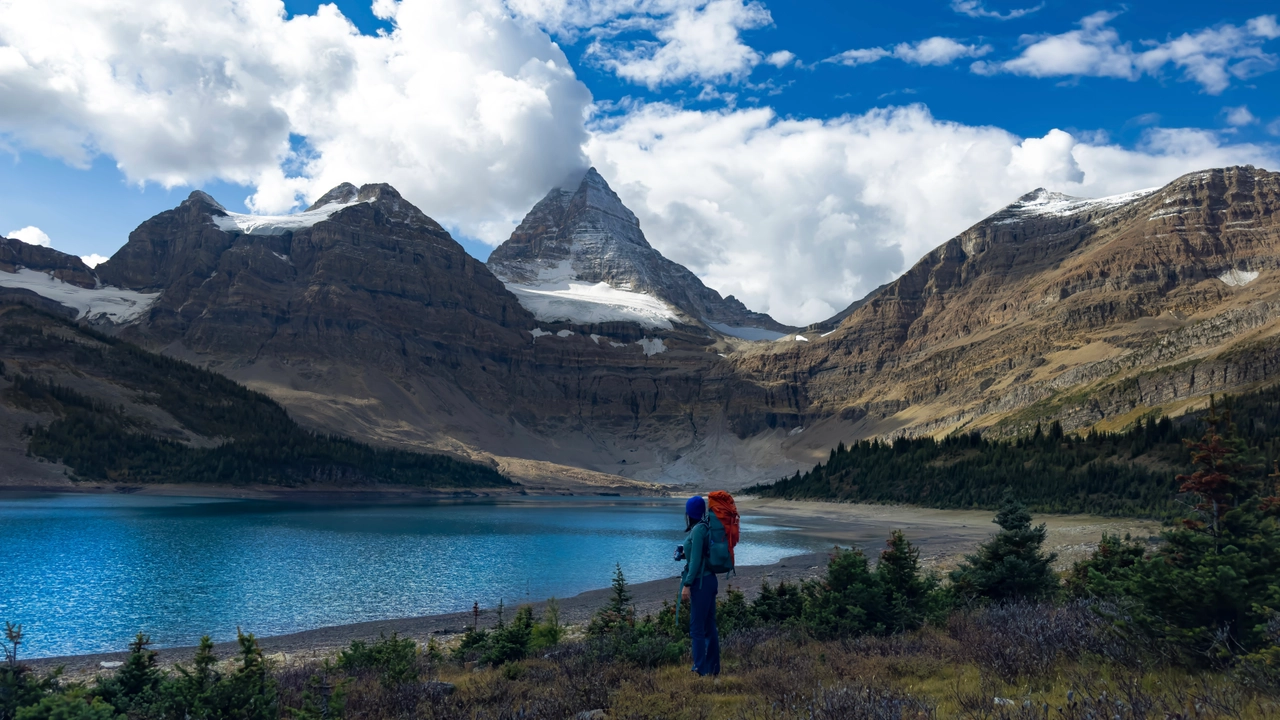
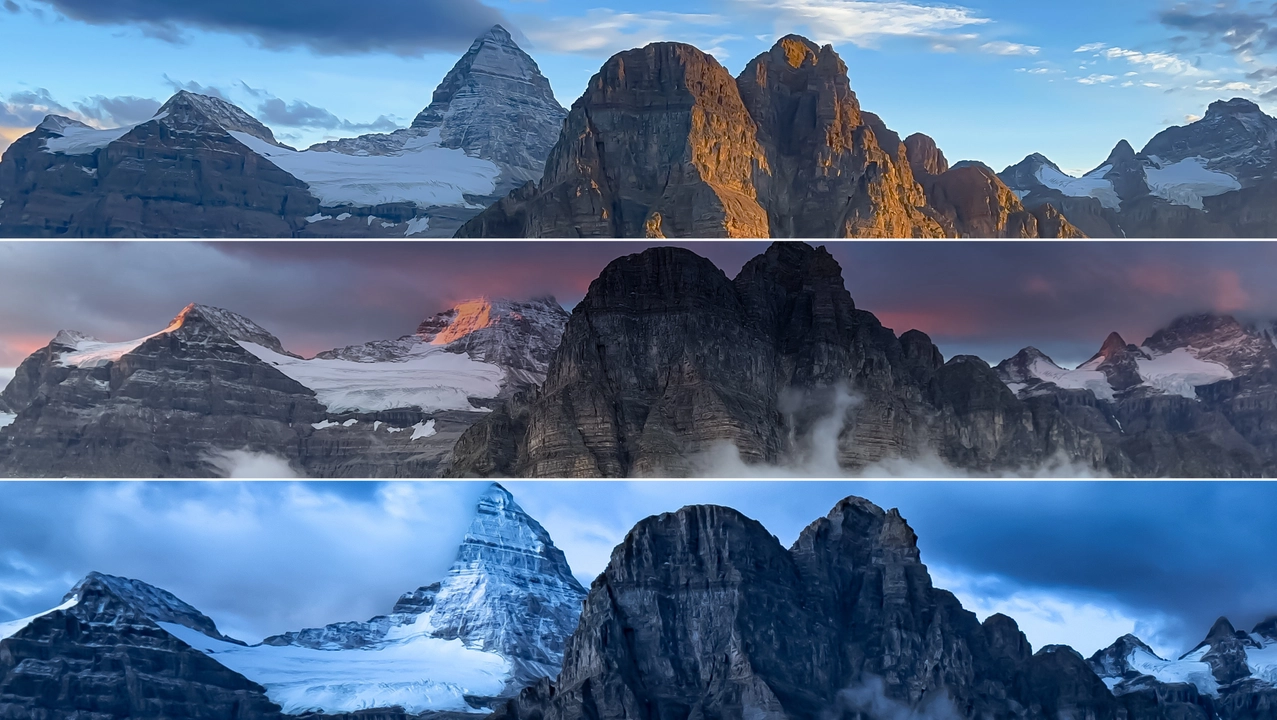
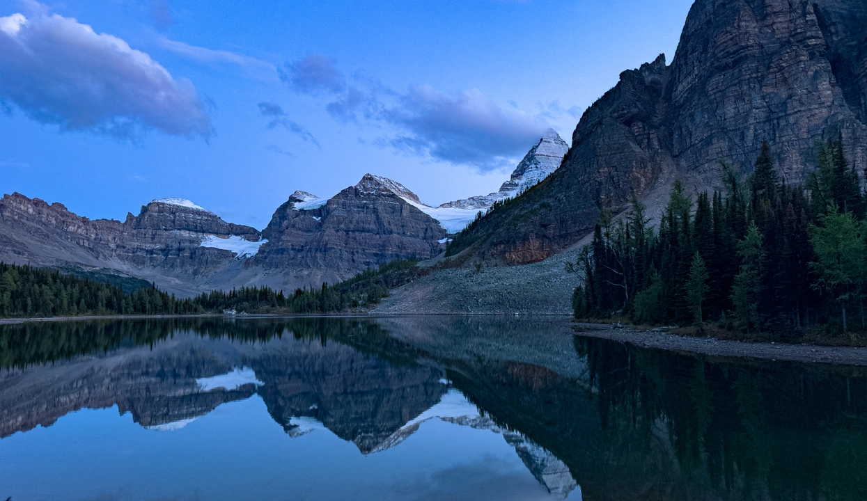
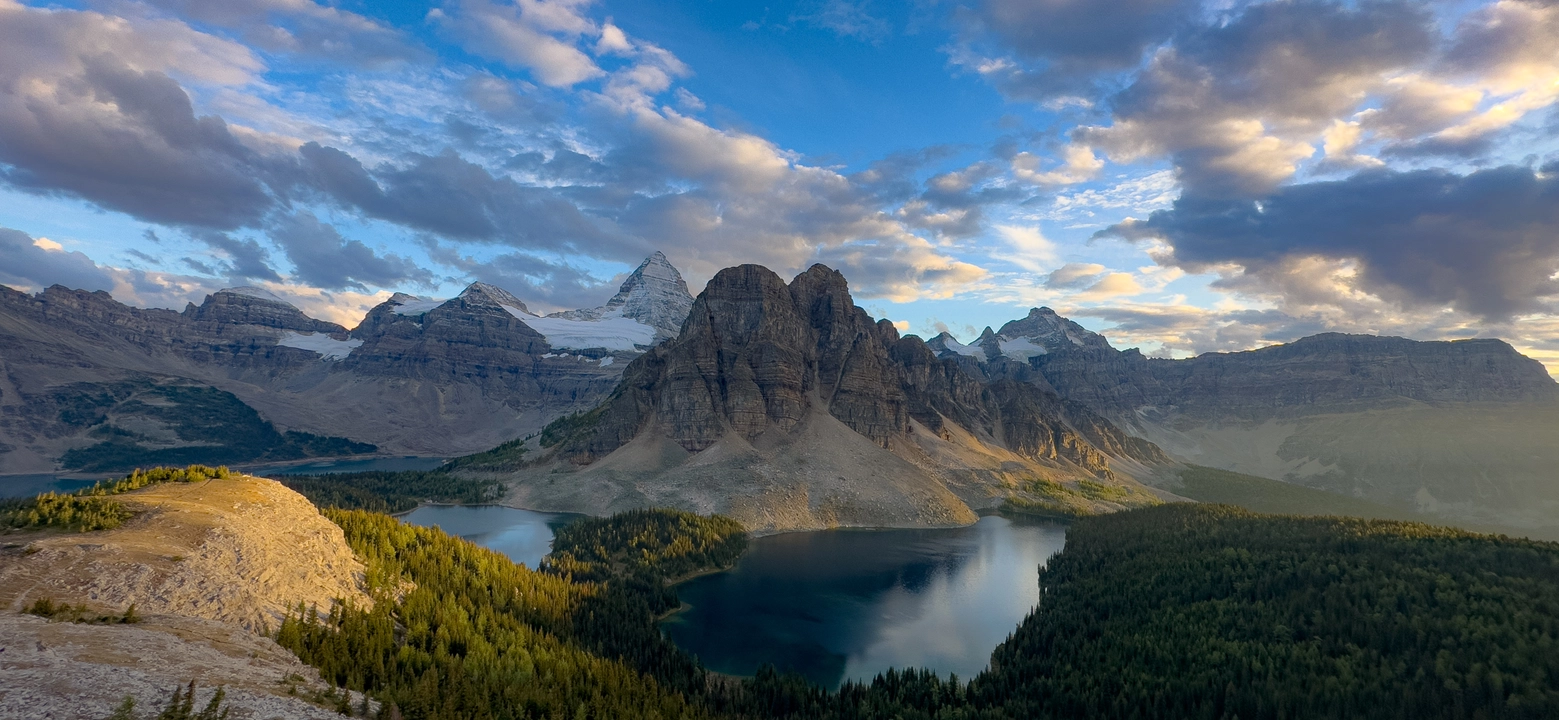
3. MOUNT ASSINIBOINE
Assiniboine Provincial Park
Hiking to Mount Assiniboine Provincial Park, often dubbed the "Matterhorn of the Rockies," offers an unparalleled backcountry experience in the Canadian Rockies. Accessible only by foot, horseback, or helicopter, the park is renowned for its dramatic alpine scenery, including the iconic Mount Assiniboine, which rises to 3,616 meters (11,864 feet) and is the highest peak in the southern Continental Ranges. The journey to the park's core area, Lake Magog, can be undertaken via several routes, each offering unique landscapes and challenges.
Popular Access Routes:
- li]:my-1">
Assiniboine Pass Route: This is the most straightforward and commonly used trail, starting from the Mount Shark Trailhead. The route spans approximately 25.5 km with an elevation gain of 766 meters and is typically completed in 8 to 11 hours. While the initial segments traverse dense forests, the trail opens up to alpine meadows and offers glimpses of surrounding peaks as you approach the pass.
Wonder Pass Route: Slightly longer at 26.7 km and with a steeper elevation gain of 1,003 meters, this trail is favored for its scenic vistas, including panoramic views of Marvel Lake and the surrounding mountains. The route shares the initial 12.4 km with the Assiniboine Pass trail before diverging towards the more challenging ascent of Wonder Pass.
Sunshine Village via Citadel Pass: Starting from the Sunshine Village ski area, this route is approximately 27.4 km to Lake Magog. It is renowned for its breathtaking alpine meadows, especially vibrant during the larch season in late September. However, hikers should be prepared for significant elevation changes and a more extended journey.
Camping and Regulations:
Backcountry camping in Mount Assiniboine Provincial Park requires reservations, especially for popular sites like Lake Magog and Og Lake. The park enforces strict regulations to preserve its delicate ecosystem, including restrictions on campfires and mandates for proper food storage to deter wildlife.
Best Time to Visit:
The optimal hiking season spans from late June to early October, with July to September offering the most stable weather conditions. During this period, trails are generally free of snow, and the alpine flora is in full bloom, enhancing the park's natural beauty.
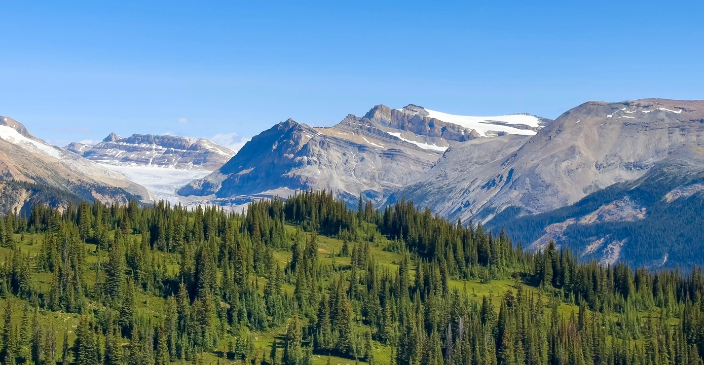
4. ICELINE YOHO VALLEY LOOP
YOHO National Park
Hiking the Iceline–Yoho Valley Loop in Yoho National Park is a breathtaking journey through some of the Canadian Rockies' most dramatic alpine scenery. This 29.4 km loop, with an elevation gain of approximately 1,430 meters, combines the Iceline Trail, Little Yoho Valley, Whaleback, and Yoho Valley Trails into a multi-day backpacking adventure. Starting at the Takakkaw Falls trailhead, hikers ascend steeply onto the Iceline Trail, where they are rewarded with panoramic views of glaciers, alpine lakes, and the towering peaks of the President Range. The trail then descends into the lush meadows of Little Yoho Valley, leading to the Stanley Mitchell Hut and designated backcountry campgrounds. Continuing over the Whaleback Trail, hikers traverse subalpine forests and meadows before descending past Twin Falls and returning via the Yoho Valley Trail. This loop is typically completed over 2 to 4 days, with the best conditions from mid-July to mid-September when the trails are snow-free.
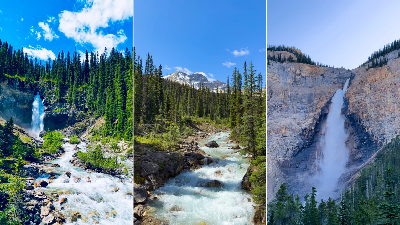
Backcountry camping permits are required and can be reserved through Parks Canada. The Stanley Mitchell Hut, managed by the Alpine Club of Canada, offers an alternative overnight option. Given the loop's elevation and exposure, hikers should be prepared for rapidly changing weather conditions and carry appropriate gear, including bear spray, as the area is home to both black and grizzly bears. It's essential to check current trail conditions and weather forecasts before embarking on this hike.
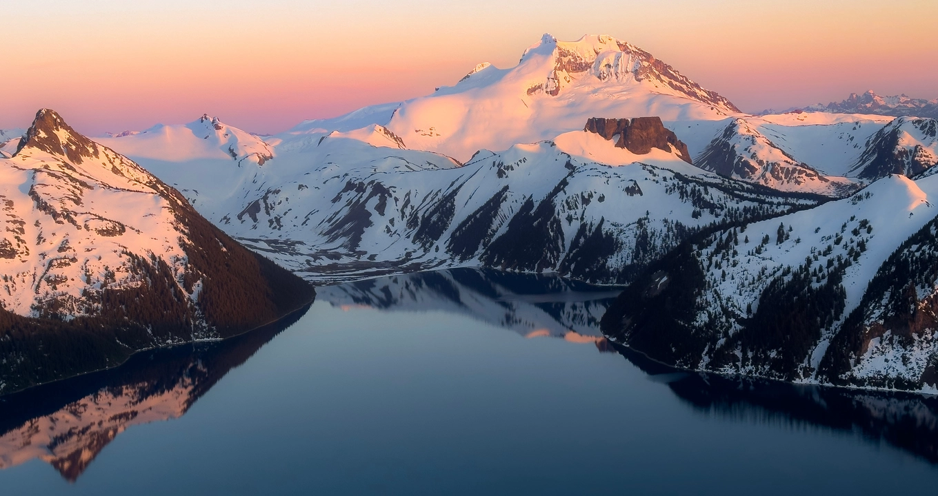
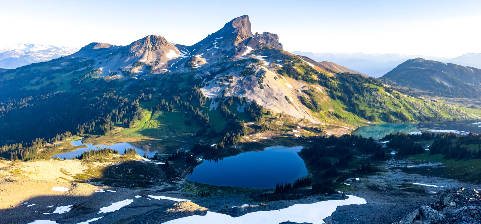
5. GARIBALDI PANAROMA RIDGE
Garibaldi Provincial Park
Panorama Ridge in Garibaldi Provincial Park is one of British Columbia’s most iconic alpine hikes, offering sweeping views of turquoise Garibaldi Lake, the Black Tusk, and surrounding glaciers. The trail begins at the Rubble Creek parking lot, located between Squamish and Whistler, and spans approximately 30 km round-trip with an elevation gain of 1,520 meters. This challenging route typically takes 10 to 12 hours to complete and is best suited for hikers with strong endurance and proper preparation.
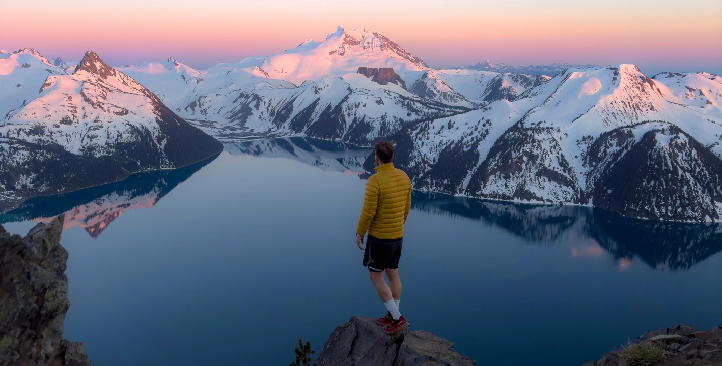
The hike starts with a series of forested switchbacks before opening into the scenic Taylor Meadows, renowned for vibrant wildflowers in late summer. From there, the trail ascends past alpine lakes and meadows, culminating in a final steep push to the ridge. The summit rewards hikers with panoramic vistas of Garibaldi Lake’s vivid blue waters framed by rugged peaks and glaciers.
Due to the hike's length and elevation, it's advisable to start early, carry sufficient water or a filtration system, and be prepared for variable mountain weather.Note that day-use passes are required during the summer months and can be reserved through BC Parks and for those seeking a less strenuous experience, consider camping overnight at Taylor Meadows or Garibaldi Lake campgrounds (reservations required), allowing for a more relaxed pace and the opportunity to witness sunrise or sunset from the ridge.
6. WEDGEMOUNT LAKE
Garibaldi Provincial Park
Hiking to Wedgemount Lake in Garibaldi Provincial Park is a strenuous yet rewarding adventure, renowned for its turquoise waters and dramatic alpine scenery. The trail spans approximately 7 km one-way, with a significant elevation gain of about 1,200 meters, making it one of the steepest hikes in the Whistler area. The path ascends through dense forests and alongside cascading waterfalls, culminating in a challenging scramble over boulder-strewn slopes before reaching the lake. Upon arrival, hikers are greeted by the stunning sight of Wedgemount Lake, nestled beneath towering peaks and fed by the Wedgemount and Armchair Glaciers .

For those wishing to extend their stay, the area offers backcountry camping with designated tent pads and a rustic hut available on a first-come, first-served basis. Camping permits are required and can be obtained through BC Parks. The best time to undertake this hike is from July to September when the trail is typically free of snow. Given the trail's steepness and technical sections, it's recommended for experienced hikers equipped with proper gear, including trekking poles and navigation tools. Always check current trail conditions and weather forecasts before embarking on this hike.
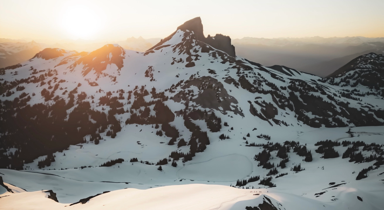
7. BLACK TUSK
Garibaldi Provincial Park
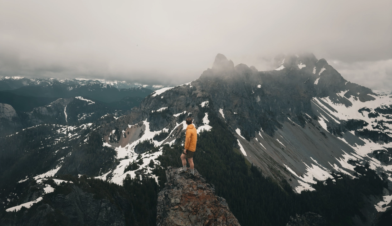
Hiking to Black Tusk in Garibaldi Provincial Park is a challenging and exhilarating alpine adventure, renowned for its dramatic volcanic spire and sweeping panoramic views. The trail spans approximately 29 km round-trip, with an elevation gain of about 1,740 meters, making it one of the most demanding day hikes in the Sea-to-Sky corridor. Starting from the Rubble Creek trailhead, the route ascends through dense forests and alpine meadows, offering glimpses of Garibaldi Lake and surrounding peaks. As hikers approach the base of Black Tusk, the terrain becomes steeper and more rugged, culminating in a Class 3 scramble over loose volcanic rock to reach the shoulder beneath the spire.

The final ascent involves navigating a narrow rock chimney to reach the south summit, which offers breathtaking views of the surrounding landscape. The true summit, located just north of the south summit, requires technical climbing skills and is rarely attempted.

The best time to undertake this hike is from July to October, when the trail is typically free of snow and the weather conditions are more favorable. Given the trail's strenuous nature and technical sections, it's recommended for experienced hikers with proper gear, including sturdy footwear, trekking poles, and navigation tools. Camping is available at nearby Taylor Meadows and Garibaldi Lake campgrounds, which require reservations through BC Parks. It's important to note that a day-use pass is required for the Black Tusk hike and can be reserved through BC Parks two days in advance of your planned hike. Always check current trail conditions and weather forecasts before embarking on this hike to ensure a safe and enjoyable experience.
8. WATERSPRITE LAKE
Squamish Mountains
Hiking to Watersprite Lake, nestled in the mountains east of Squamish, offers a rewarding alpine adventure. The trail spans approximately 17 to 20 kilometers round-trip, with an elevation gain of around 650 to 1,136 meters, depending on the route taken . The journey begins along decommissioned logging roads and transitions into well-marked forested paths, leading hikers through diverse terrains, including boulder fields and alpine meadows. The final ascent is a steep climb over rocky terrain, culminating in the breathtaking sight of Watersprite Lake's turquoise waters set against dramatic peaks like Martin and Dreadnought .
Accessing the trailhead requires a high-clearance vehicle, preferably with 4WD or AWD, as the last 6 kilometers of the Mamquam and Skookum Forest Service Roads are notably rough . For those wishing to extend their stay, the British Columbia Mountaineering Club (BCMC) manages a campground at the lake, featuring tent platforms and a cabin. Reservations are mandatory and can be made up to 60 days in advance through the BCMC reservation system. Campers should be prepared for changing weather conditions and practice Leave No Trace principles to preserve the area's natural beauty.
9. MOUNT LINDEMAN
Chilliwack Lake Park
Hiking Mount Lindeman in British Columbia's North Cascades offers a challenging yet rewarding alpine adventure for experienced hikers. Standing at 2,312 meters, Mount Lindeman is the highest peak within Sx̱ótsaqel/Chilliwack Lake Provincial Park, located approximately 1.6 km north of the Canada–U.S. border.
The trailhead is accessed via the Centre Creek Forest Service Road (FSR), which requires a high-clearance vehicle due to its rough condition and numerous cross ditches. From the trailhead, the route spans approximately 16.4 km round-trip with an elevation gain of about 1,417 meters. The initial 3 km of the trail follows an overgrown logging road, featuring creek crossings and muddy sections. After reaching the meadow, hikers encounter a steep ascent through a boulder field leading to the base of the summit scramble. The final push to the summit involves a straightforward, low class 3 scramble with minimal exposure.
The best time to attempt this hike is from mid-July to mid-October, when snow has melted and Upper Hanging Lake, a highlight of the hike, is typically thawed. Due to the trail's rugged nature and the technical scramble, this hike is recommended for those with alpine experience. Dogs are allowed but may struggle with the boulder sections.
10. MOUNT MACFARLANE
Chilliwack Lake Park
Hiking Mount MacFarlane in British Columbia's Fraser Valley is a demanding yet rewarding adventure, offering panoramic views and alpine lakes. The trail spans approximately 18.5 km round-trip with an elevation gain of about 1,900 meters, making it one of the steepest hikes in the region.
- li]:my-1 tight" data-tight="true">
Trailhead Access: The hike begins from a parking area along Chilliwack Lake Road, accessible by standard vehicles.
Lower Pierce Lake: After a strenuous ascent through dense forest and over roots and rocks, hikers reach Lower Pierce Lake at approximately 8 km, having gained around 900 meters in elevation.
Upper Pierce Lake: Continuing for another 2 km with an additional 300 meters of elevation gain, the trail leads to Upper Pierce Lake, a pristine alpine lake surrounded by rugged peaks.
Summit Push: The final 2 km to the summit involves a steep ascent with about 400 meters of elevation gain, featuring loose scree and mild scrambling sections.
Camping Options:
Backcountry camping is permitted at both Lower and Upper Pierce Lakes. Many hikers choose to camp overnight to break up the challenging ascent and enjoy the serene alpine environment.
Best Time to Hike:
The optimal hiking season is from mid-July to mid-October when the trail is typically free of snow, and wildflowers are in bloom.

11. LADY PEAK
Chilliwack Lake Park
Hiking Lady Peak, located next to the iconic Mount Cheam in the Fraser Valley of British Columbia, is a rugged and rewarding alpine adventure that offers a more challenging alternative to its popular neighbor. The route begins along the same trail as Mount Cheam, branching off at the saddle between the two peaks. From there, the trail becomes steeper and more technical, requiring scrambling, careful footing, and some route-finding skills. The total distance is approximately 9 kilometers round-trip with about 900 meters of elevation gain, and the trail is typically free of snow by mid-summer.
What sets Lady Peak apart is its sense of solitude and the commanding views from its summit. While Cheam attracts crowds, Lady offers a quieter, more adventurous path with panoramic views stretching across the Fraser Valley, the Cheam Range, and all the way to Mount Baker on a clear day. The final ascent involves steep scree and hands-on scrambling, but the effort is well worth it. Hikers are advised to bring proper footwear, stay aware of loose rock, and only attempt the summit in stable weather conditions. For those looking for a bit more challenge and raw alpine beauty, Lady Peak is a lesser-traveled gem that rewards with both adrenaline and awe.favorable.
12. CHEAM PEAK
Chilliwack Lake Park
Hiking Cheam Peak is one of the most iconic alpine experiences in the Fraser Valley, offering panoramic views with a relatively moderate effort. The trailhead is accessed via a high-clearance forest service road, and once on the trail, hikers follow a well-marked 9.5-kilometer round-trip route with around 700 meters of elevation gain. The trail winds through open alpine meadows filled with wildflowers in late summer, with constant views of the surrounding mountains and valleys. The final ascent is steady but not technical, making this a rewarding option for both experienced hikers and fit beginners looking to explore high-elevation terrain.
The summit of Cheam Peak provides a breathtaking 360-degree view that stretches over the Fraser Valley, the Cheam Range, and all the way to Mount Baker and the Coast Mountains. On a clear day, you can even see the distant peaks of the North Cascades. The sense of space and scale from the summit is awe-inspiring, and the journey to get there, across wildflower slopes, ridgelines, and exposed alpine terrain makes for a memorable day in the mountains. Cheam is especially popular in late July through September when conditions are dry and visibility is ideal. Whether you are looking to photograph sweeping mountain vistas, share a peak with friends, or simply soak in BC’s alpine beauty, Cheam Peak is a must-do classic.
13. GOAT RIDGE
Chilliwack Lake Park
Hiking Goat Ridge in the Fraser Valley was an unforgettable experience that pushed me both physically and mentally, but the reward was absolutely worth it. The trail is steep and relentless right from the start, gaining elevation quickly as it weaves through dense forest. It demands a solid level of fitness and some determination, but as you climb higher, the trees begin to open up and the surrounding alpine scenery starts to unfold. The trail becomes more scenic and dramatic the further you go, with rocky ridgelines and mountain views that make every step feel worthwhile.
Reaching the viewpoint was the highlight of the day. From there, I was greeted with a breathtaking panorama of Mount Slesse and a sea of rugged peaks stretching far into the horizon. The scale and beauty of the landscape were humbling, and the peaceful silence at the top made all the effort feel deeply rewarding. For anyone planning to hike Goat Ridge, I recommend starting early, bringing plenty of water, wearing proper hiking boots for the rocky terrain, and pacing yourself through the steep initial climb. Goat Ridge may be a tough ascent, but the solitude, challenge, and spectacular views make it one of the hidden gems of the Fraser Valley.
14. FLOE LAKE
Kootenay National Park
Hiking to Floe Lake in Kootenay National Park is a challenging yet rewarding experience, offering hikers stunning alpine scenery and the opportunity to camp beside a pristine glacial lake. The trailhead is located off Highway 93, approximately 64 km from Banff or 72 km from Radium Hot Springs .
The hike to Floe Lake is approximately 10.5 km one-way, with an elevation gain of about 1,100 meters. The trail begins with a steady ascent through areas affected by past wildfires, providing open views of the surrounding landscape. As you progress, the path becomes steeper, culminating in a series of switchbacks before reaching the lake.Upon arrival, hikers are greeted by the turquoise waters of Floe Lake, set against the dramatic backdrop of the Rockwall. For those interested in extending their adventure, the trail continues beyond the lake to Numa Pass, adding approximately 2.8 km one-way and an additional 300 meters of elevation gain.
Camping at Floe Lake requires a backcountry permit, and the campground offers 18 sites equipped with pit toilets, bear-proof storage lockers, and picnic tables. The camping season typically runs from July 10 to early October, depending on snow conditions.
The best time to hike to Floe Lake is from mid-July to early October, when the trail is generally free of snow. Late summer and early fall offer the added beauty of wildflowers and golden larch trees, enhancing the already spectacular views.
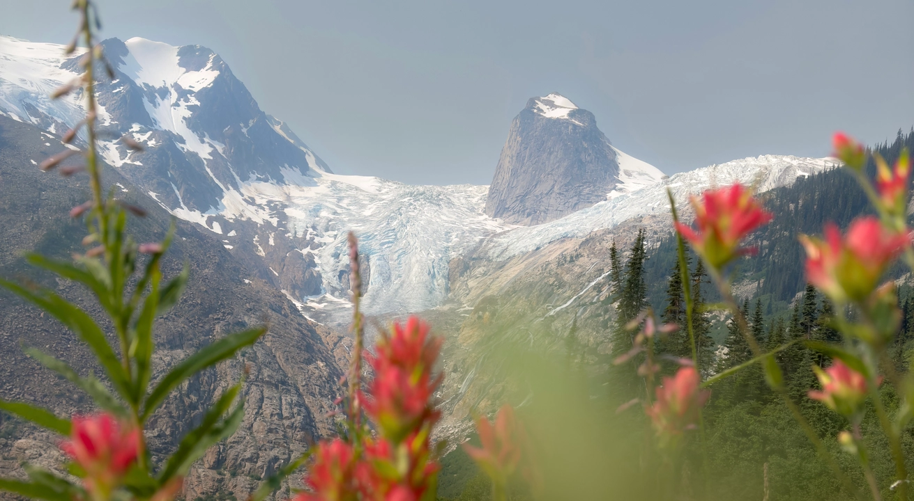
15. JUMBO PASS
Kootenay National Park
Hiking to Jumbo Pass is a breathtaking adventure that lies between the towering Purcell and Selkirk mountain ranges in British Columbia. The trail to the pass is approximately 10.5 kilometers round-trip with about 780 meters of elevation gain, offering a consistent climb through lush cedar and spruce forest before opening up into expansive alpine meadows.
As you make your way upward, the scenery changes rapidly, revealing panoramic views of glaciated peaks, flower-filled slopes, and the striking presence of Jumbo Glacier in the distance. The final stretch to the pass rewards you with a stunning vista of Baldur Mountain and a view of the quaint Jumbo Cabin, perched perfectly on the ridgeline. This high mountain saddle, sitting between two vast valleys, feels remote and pristine, offering an unmatched sense of tranquility and grandeur.
What makes the experience of reaching Jumbo Pass so memorable is not only the spectacular scenery but also the peaceful connection to the land. Standing at the top, surrounded by ancient peaks and the gentle rustle of alpine winds, you feel a profound stillness and clarity. The trail is best explored between July and September, when the snow has melted and the alpine wildflowers are in full bloom. Although the hike is not technically difficult, it does require a good level of fitness, especially during the final ascent to the ridge. For those seeking solitude and dramatic mountain views without the crowds, Jumbo Pass provides the perfect balance of effort and reward, leaving you feeling refreshed, inspired, and deeply connected to British Columbia’s wild alpine landscape.

16. MOUNT FISHER
Kootenay National Park
Hiking Mount Fisher, is one of the most iconic and demanding alpine climbs in British Columbia’s East Kootenay region. Towering at 2,846 meters, it offers a steep and relentless 9 km round-trip trail with over 1,300 meters of elevation gain. The route starts in dense forest and transitions into alpine meadows, scree slopes, and boulder fields. The final ascent to the summit involves route-finding over exposed rock and loose scree, making it suitable only for experienced hikers comfortable with scrambling and heights. The reward at the top is a breathtaking 360° panorama of the Rocky Mountain Trench, Kootenay River Valley, and surrounding peaks.
Access to the trailhead requires a high-clearance vehicle via the rugged Mause Creek Forest Service Road near Fort Steele. This hike is best done between late June and early October when snow has melted and the trail is most accessible. Due to the elevation, unpredictable weather, and rockfall hazards, proper preparation, including maps, layers, and solid footwear is essential. For those ready to tackle the challenge, Mount Fisher delivers one of the most rewarding summit views in the southern Canadian Rockies.
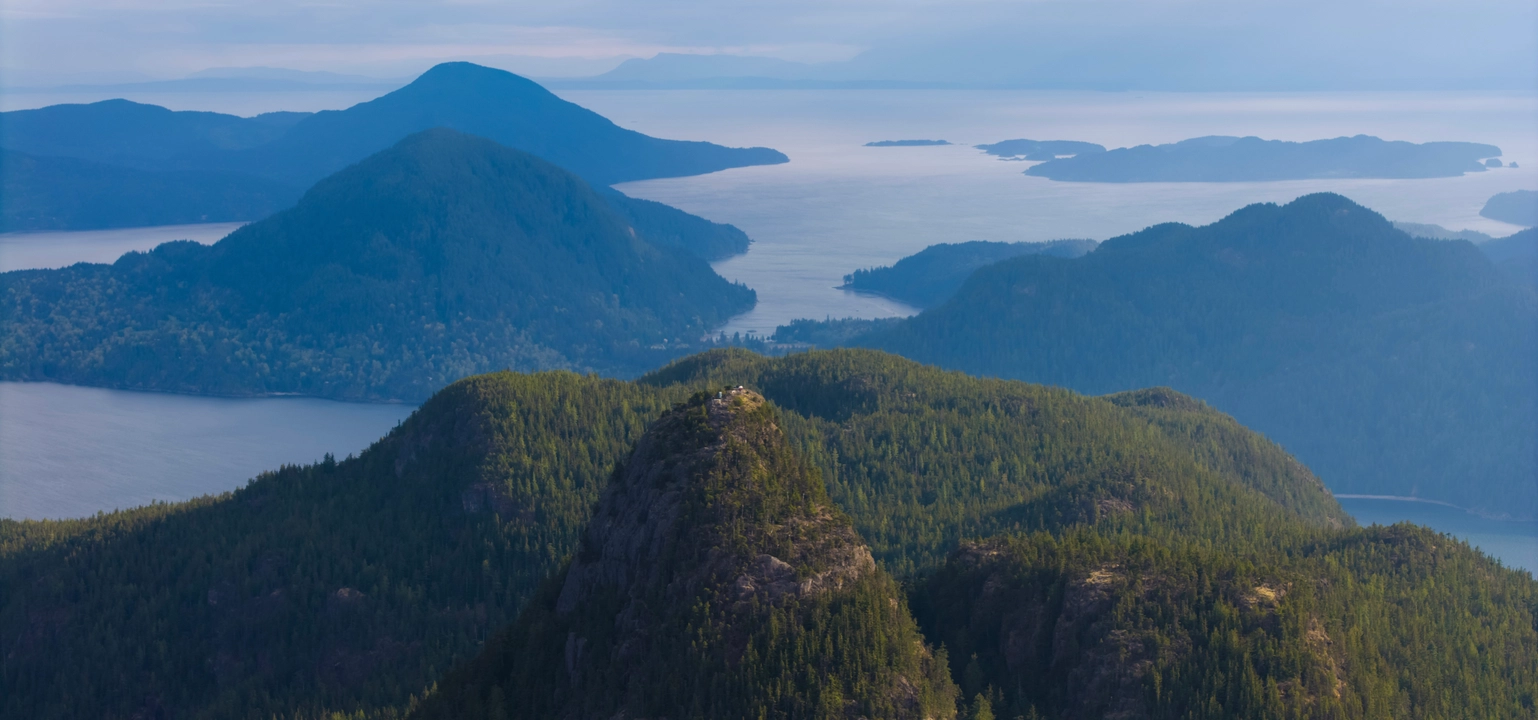
17. TIN HAT
SUNSHINE COAST
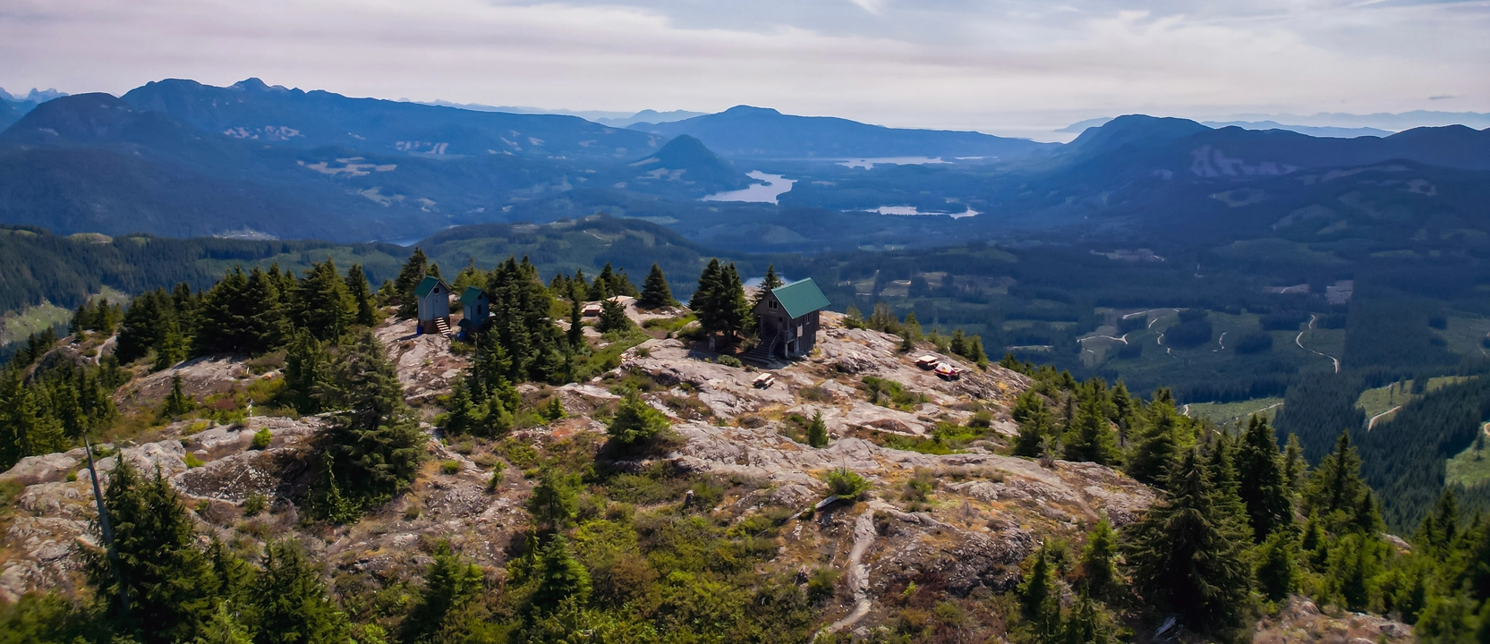
Hiking to Tin Hat Mountain along the Sunshine Coast Trail offers an unforgettable alpine experience with panoramic vistas of British Columbia's rugged backcountry. Situated roughly at the midpoint of the 180 km Sunshine Coast Trail, Tin Hat Mountain stands at an elevation of approximately 1,193 meters. The summit provides a 360-degree view encompassing Powell Lake, the Horseshoe Valley, and the distant Coast Mountains.
The trail to the summit can be accessed via the Old Tin Hat Road/Trail, with the shortest route being a 4.2 km round-trip hike featuring a moderate elevation gain. This path meanders through dense forests and alpine meadows, culminating in the iconic Tin Hat Hut, a fully insulated cabin equipped with a pellet stove, offering shelter for up to 10 hikers. The hut's strategic location and amenities make it a popular choice for both day hikers and those undertaking multi-day treks along the trail.
Accessing the trailhead requires a high-clearance vehicle, as the final stretch involves navigating rugged logging roads. Once on the trail, hikers should be prepared for rapidly changing weather conditions, especially given the mountain's elevation. The best time to hike Tin Hat Mountain is from late spring to early fall when the trail is typically free of snow. However, the hut's winterization allows for snowshoeing adventures during colder months. It's essential to practice Leave No Trace principles to preserve the area's natural beauty and to check current trail conditions before embarking on the hike.
18. GIMLI RIDGE
Valhalla Provincial Park
Hiking to Gimli Ridge in Valhalla Provincial Park, British Columbia, offers a challenging yet rewarding alpine experience. The trail spans approximately 9.5 km round-trip with an elevation gain of about 857 meters. Beginning through dense forests, the path ascends steeply, crossing a creek before transitioning into alpine meadows adorned with wildflowers during the summer months. As hikers approach the ridge, the terrain becomes rockier, leading to panoramic views of the surrounding peaks, including the iconic Gimli Peak, a striking granite monolith reminiscent of formations found in Yosemite Valley. The trail culminates at an exposed ledge overlooking the Mulvey Basin, offering vistas of jagged summits like Nisleheim, Midgard, Asgard, and Gladsheim Peaks.
The area is known for its resident mountain goats, which are often spotted along the trail. Hikers are advised to maintain a respectful distance and avoid leaving behind salt residues, as these attract the goats . Given the trail's exposure and potential for sudden weather changes, it's recommended to carry appropriate gear, including layers and bear spray, as the region is also grizzly bear territory . The best time to hike Gimli Ridge is from July to September when the trail is typically free of snow. Access to the trailhead requires navigating rough logging roads, so a high-clearance vehicle is recommended.
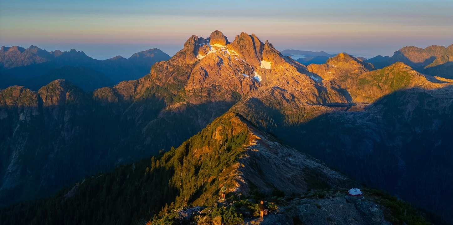
19. TRIPLE PEAK
Kennedy River Woodlands
Triple Peak, located on Vancouver Island, British Columbia, offers a challenging alpine adventure for experienced hikers and scramblers. The trail begins near the Marion Creek Forest Service Road, approximately 46 km west of Port Alberni along Highway 4. Accessing the trailhead may require a high-clearance vehicle due to rough road conditions. The route ascends steeply alongside a series of waterfalls, leading to a picturesque alpine lake beneath the mountain's jagged peaks. This segment involves rugged terrain, including muddy sections and third-class scrambling, with some areas equipped with fixed ropes to assist hikers. The lake serves as a popular spot for overnight camping, providing a base for those aiming to summit.
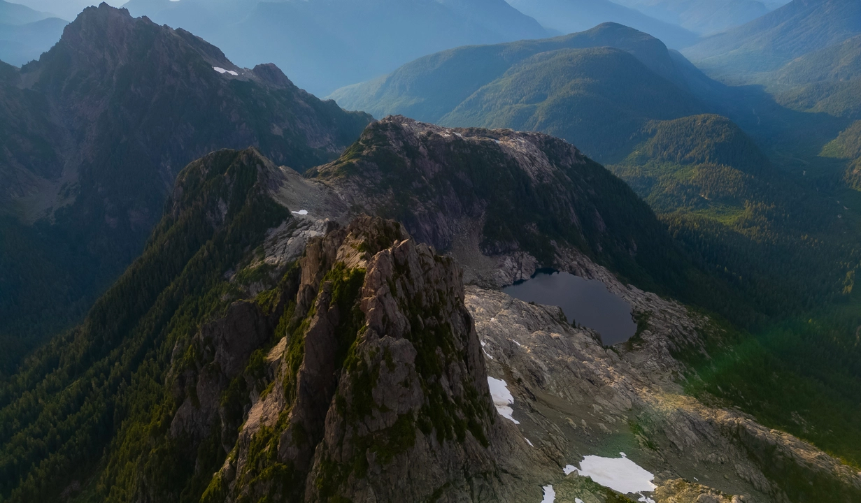
Reaching the summit of Triple Peak requires navigating exposed fourth- to low fifth-class scrambling, with the Southeast Ridge being the most accessible route. While the rock quality is generally solid, the final ascent demands careful route-finding and comfort with exposure. Many climbers opt to use ropes for safety during both ascent and descent. The summit rewards climbers with panoramic views of the surrounding alpine landscape. Given the technical nature of the climb, it's recommended for those with alpine scrambling experience.
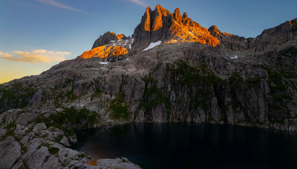
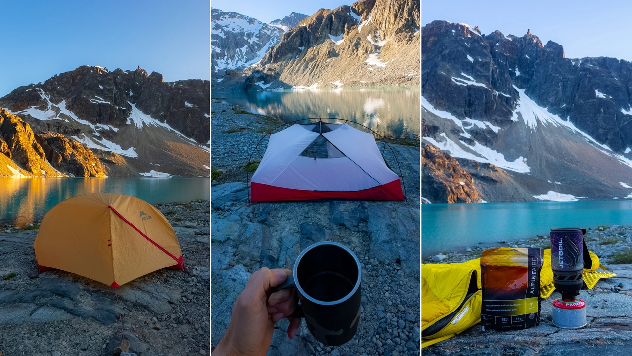
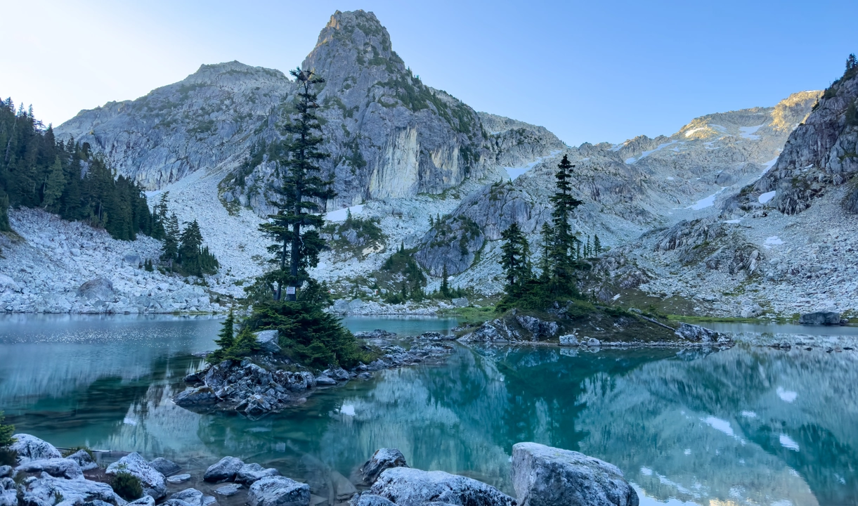
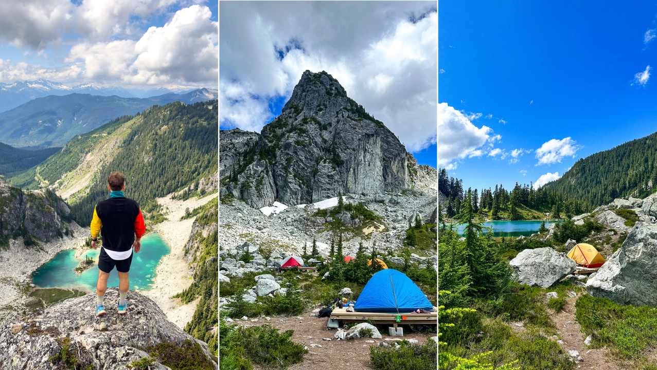
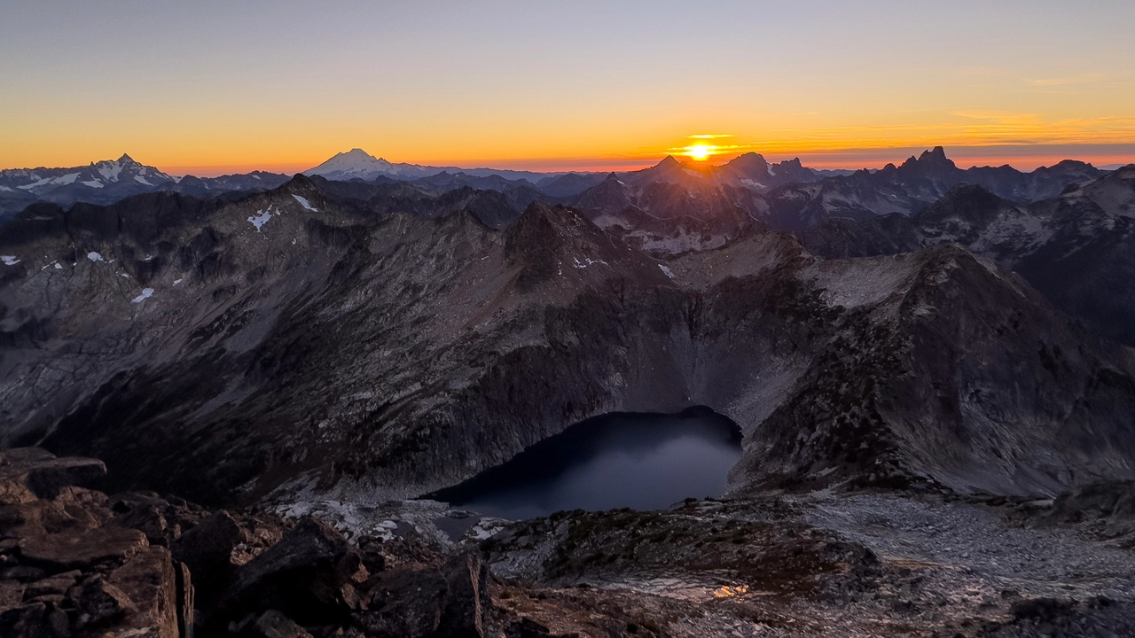
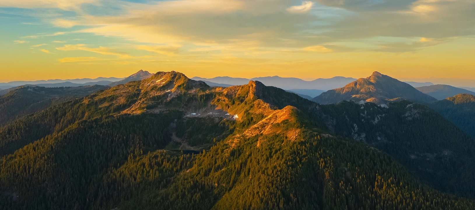
20. 5040 PEAK
Kennedy River Woodlands
Hiking 5040 Peak on Vancouver Island offers a challenging yet rewarding alpine adventure. The trail spans approximately 6.9 km round-trip with an elevation gain of about 928 meters, making it a steep ascent through diverse terrains. Starting from the trailhead near Marion Creek Forest Service Road, hikers navigate through dense old-growth forests, cross streams, and ascend rugged alpine slopes. Midway, the trail passes by the serene Cobalt Lake, a picturesque spot ideal for rest or camping. Beyond the lake, the path becomes steeper and more technical, leading to the summit that offers panoramic views of the surrounding peaks and the Pacific coastline.
For those seeking an overnight experience, the Alpine Club of Canada's Hišimy̓awiƛ Hut near Cobalt Lake provides shelter with basic amenities. Reservations are required and can be made through the Alpine Club of Canada's Vancouver Island Section. The best time to hike 5040 Peak is from July to September when the trail is typically free of snow. Given the trail's steepness and technical sections, it's recommended for experienced hikers equipped with proper gear, including trekking poles and navigation tools. Always check current trail conditions and weather forecasts before embarking on the hike.
21. LANDSLIDE LAKE
Strathcona Provincial Park
Hiking to Landslide Lake via the Elk River Trail in Strathcona Provincial Park is a rewarding journey through Vancouver Island's rugged wilderness. The trail spans approximately 21.2 km round-trip with an elevation gain of about 600 meters, making it a moderate to challenging hike suitable for both seasoned hikers and adventurous beginners. The path meanders alongside the Elk River, offering picturesque views of old-growth forests, cascading waterfalls, and vibrant wildflowers during the summer months. Two designated campsites, Butterwort Flats at 6 km and Upper Gravel Bar at 9 km provide ideal spots for overnight stays. Camping is not permitted at Landslide Lake itself to preserve its pristine condition.
The final stretch to Landslide Lake involves a steeper ascent over exposed bedrock and may require careful navigation, especially in wet conditions. Upon arrival, hikers are rewarded with the lake's stunning turquoise waters set against the dramatic backdrop of Mount Colonel Foster's towering cliffs. For those seeking further adventure, a challenging route continues beyond Landslide Lake to Berg Lake, also known as Foster or Iceberg Lake. This extension involves bushwhacking through dense vegetation and is recommended only for experienced hikers.
The best time to hike is from late June to early October when the trail is typically free of snow. Permits are required for overnight camping and can be obtained through BC Parks. Always practice Leave No Trace principles to help preserve the natural beauty of this remarkable area.
22. BEDWELL LAKE TRAIL
Strathcona Provincial Park
Hiking to Bedwell Lake and extending onward to Cream Lake in Strathcona Provincial Park offers a stunning alpine experience on Vancouver Island. The trail to Bedwell Lake spans approximately 13 km round-trip with an elevation gain of about 600 meters. The path is well-maintained, featuring engineered bridges, staircases, and boardwalks that guide hikers through lush old-growth forests and alongside cascading streams. Upon reaching Baby Bedwell Lake, hikers can take a moment to rest before continuing to Bedwell Lake, which provides breathtaking views of Mount Tom Taylor and Big Interior Mountain. Designated campsites are available at both lakes, equipped with tent pads and bear caches. Backcountry camping permits are required and can be obtained through BC Parks.
For those seeking a more challenging adventure, the trail extends from Bedwell Lake to Cream Lake, adding approximately 10 km round-trip and an additional 600 meters of elevation gain. This section of the trail is more rugged and less maintained, requiring hikers to navigate through alpine meadows and rocky terrains. Cream Lake is nestled beneath the imposing peaks of Mount Septimus and Mount Rosseau, offering a serene and picturesque setting. Due to the trail's difficulty and length, it's recommended for experienced hikers and is often undertaken as a multi-day backpacking trip. Always check current trail conditions and weather forecasts before embarking on this hike.
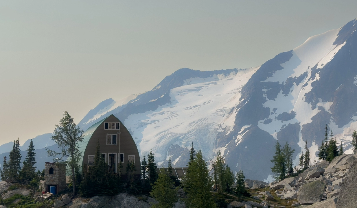
23. FROSTY MOUNTAIN
Manning Provincial Park
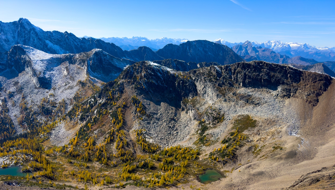
Hiking Frosty Mountain in E.C. Manning Provincial Park is a premier alpine adventure, especially renowned during late September to early October when the ancient larch trees turn a brilliant gold. The trail offers two primary routes: a 22 km out-and-back with approximately 1,160 meters of elevation gain, and a more challenging 31.5 km loop via Windy Joe Trail, which adds scenic variety and solitude . Starting from the Lightning Lake day-use area, hikers ascend through dense forests, reaching the Frosty Creek campsite around the 7.5 km mark. Beyond this point, the trail unveils a stunning larch forest, leading to a steep boulder field that requires light scrambling to reach the ridge line. From the ridge, panoramic views of the surrounding peaks and valleys await, making the strenuous climb worthwhile.
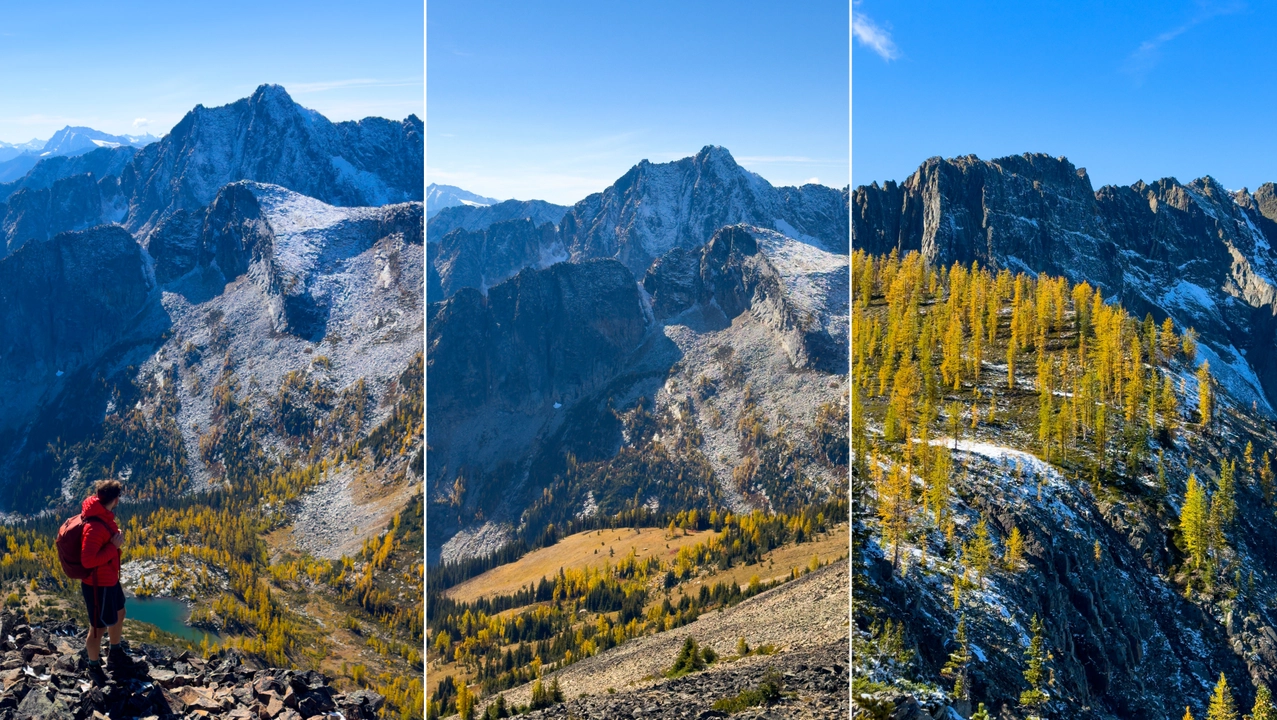
The golden larch display is a significant draw, but it's fleeting—typically peaking between late September and early October . Given the popularity during this period, it's advisable to start early or consider weekday hikes to avoid crowds. Weather conditions can change rapidly; snow and sub-zero temperatures are common even in early fall, so appropriate gear, including microspikes and layered clothing, is essential . Camping is permitted at Frosty Creek campsite, but reservations are required through BC Parks.
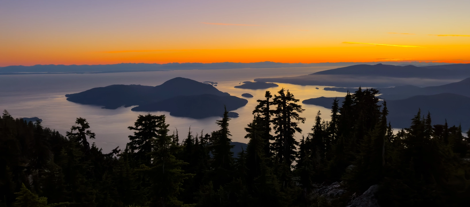
24. HOWE SOUND CREST TRAIL
Cypress Provincial Park
Hiking the Howe Sound Crest Trail (HSCT) in a single day is a bold and unforgettable mountain mission. Spanning nearly 30 km with over 2,500 meters of elevation gain, the route begins at Cypress Mountain and finishes at Porteau Cove, weaving its way across some of the most iconic and challenging terrain in the Sea-to-Sky region. Completing this traverse in just 7 hours is not only physically demanding but mentally exhilarating. From the outset, the trail climbs to St. Mark’s Summit, offering a taste of the grandeur to come with stunning views of Howe Sound and the distant Gulf Islands.
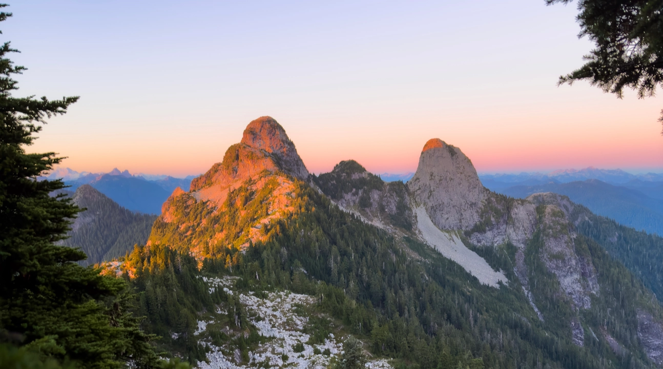
The technicality increases rapidly steep, rooty ascents and descents lead to Unnecessary Mountain, and from there, a bold push to the unmistakable twin spires of The Lions tests both endurance and agility. The exposed ridgelines, boulder scrambles, and narrow traverses require confident footwork, a strong cardiovascular base, and efficient time management.
The payoff is enormous. As you move past James Peak, David Peak, and the subalpine basins that follow, you’re gifted with breathtaking panoramas at every turn and glimpses of Garibaldi, Sky Pilot, and the sparkling blue of Deeks Lake far below. One of the most rewarding aspects of doing HSCT in a single day is the sense of solitude; what is typically a two- or three-day trek for most becomes a fluid, continuous dance with the terrain when done in one go. With alpine meadows, steep talus slopes, narrow ridges, and high passes constantly shifting underfoot, this route keeps you fully immersed and alive in the moment. Crossing the final descent into Porteau Cove, legs burning and heart full, there’s a deep sense of awe, not just at the beauty of British Columbia’s wild terrain, but at what’s possible when preparation, willpower, and passion for the mountains come together.
25. GOAT RIDGE via Britannia beach
Cypress Provincial Park
Hiking Goat Ridge via Britannia Beach is a challenging yet incredibly rewarding adventure tucked away in the Sea to Sky corridor. The trail begins just outside Britannia Beach and wastes no time in gaining elevation. The first few kilometers are a steep and sustained climb through dense forest, with sections of loose dirt and roots that require careful footing and strong legs. It’s not for the faint of heart, but the effort pays off as the forest gradually opens to reveal sweeping views of the Howe Sound, coastal peaks, and eventually the stunning ridgeline that gives this trail its name.
The final push to the Goat Ridge viewpoint is truly breathtaking. From the top, you’re treated to panoramic views of Sky Pilot, Mount Habrich, Brunswick Mountain, and the surrounding alpine wilderness, all framed by the glittering waters of Howe Sound below. It’s a place that feels wild and remote, even though it's not far from the highway. Hikers should come prepared with proper footwear, plenty of water, and GPS navigation, as the trail can be overgrown and hard to follow in places. Starting early is key to making the most of daylight, especially given the steep climb and technical sections. Goat Ridge via Britannia Beach is one of those hikes that pushes your limits and rewards you with unforgettable views and a deep sense of accomplishment.
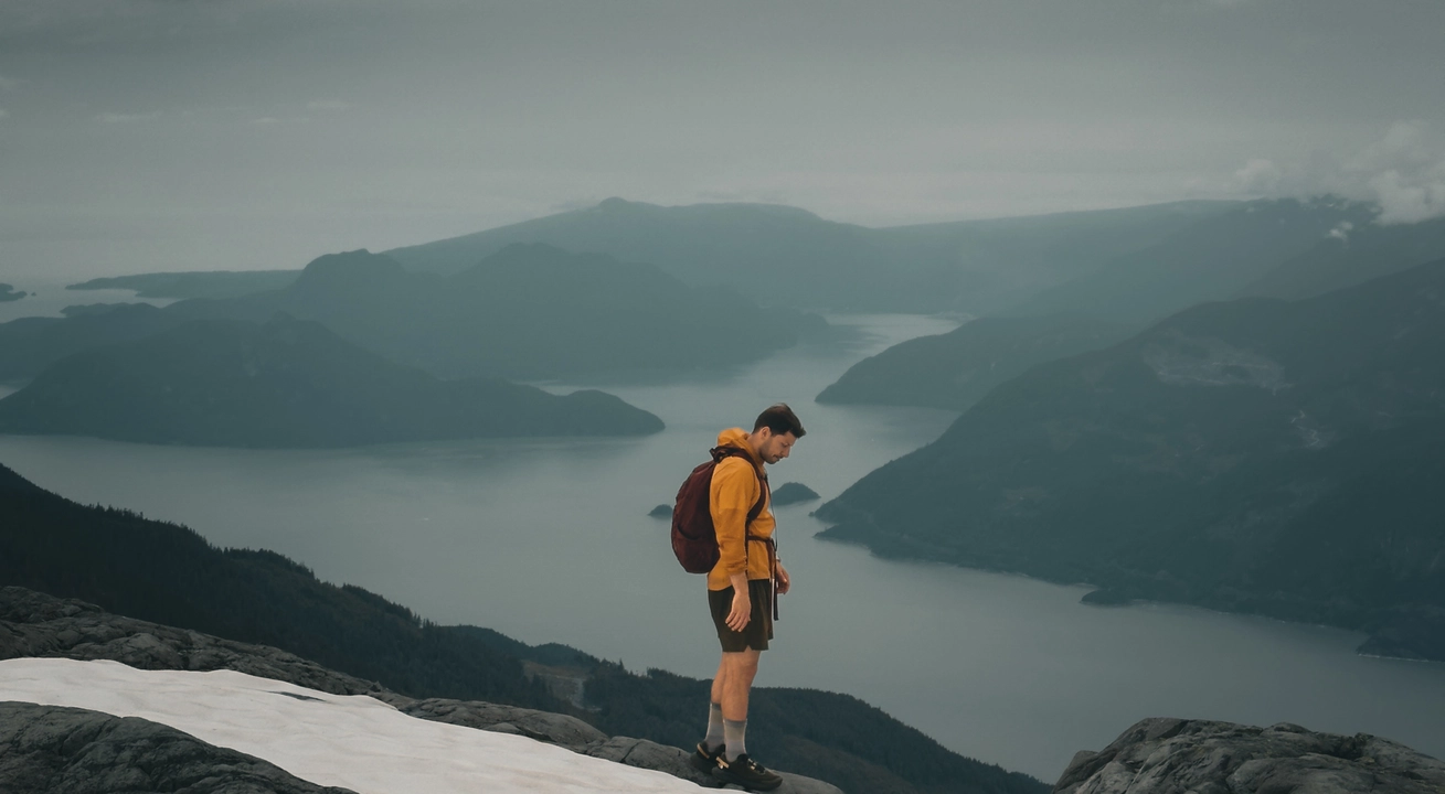
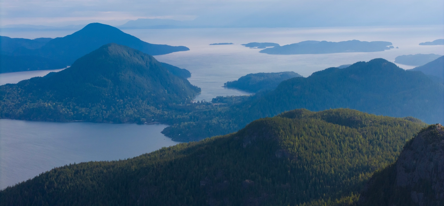
26. LEADING PEAK
Anvil Island
Hiking to Leading Peak on Anvil Island is a rewarding and adventurous experience that offers panoramic views of Howe Sound and the surrounding mountains. The trail begins at the Daybreak Point Bible Camp on the southern tip of the island, and hikers must obtain permission to access the trailhead, as much of the area is on private property. It's recommended to contact the camp in advance to arrange access and obtain directions. Hiking to Leading Peak on Anvil Island is a rewarding and adventurous experience that offers panoramic views of Howe Sound and the surrounding mountains. The trail begins at the Daybreak Point Bible Camp on the southern tip of the island, and hikers must obtain permission to access the trailhead, as much of the area is on private property. It's recommended to contact the camp in advance to arrange access and obtain directions.
The hike to Leading Peak is approximately 9 kilometers round-trip with an elevation gain of about 765 meters. The trail is steep and can be challenging, especially near the summit where scrambling over rocks and roots may be required. The route is generally well-marked with orange flagging tape, but it's advisable to download a GPS map for navigation.
At the summit, hikers are rewarded with breathtaking 360-degree views, including vistas of Mount Garibaldi, the Tantalus Range, Sky Pilot, and the Sunshine Coast. The island's rugged terrain and the surrounding fjords create a sense of isolation and tranquility, making it a perfect spot for reflection and appreciation of nature's beauty.
Access to Anvil Island is limited to private boats or kayaks, as there are no public ferry services. Hikers can arrange water taxis from Horseshoe Bay or Porteau Cove, with companies like Cormorant Marine and Mercury Transport offering services.
For those seeking a challenging hike with rewarding views and a sense of solitude, Leading Peak on Anvil Island is an excellent choice. Proper preparation, including obtaining access permissions and arranging transportation, is essential for a successful and enjoyable hike.